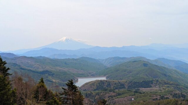

Starting from Tsugaike Nature Park at an elevation of 1,900m ~ through the spacious marshland of Tengu-hara ~ over the rocky ascent of the forest zone ~ down to the summit of Mount Norikura, Hakuba ~ you will reach the beautiful blue Hakuba Ooike Pond! 2,379 m above sea level and 2 km in circumference, the view created between Norikura-dake and Hakuba-dake is beautiful, with clusters of flowers such as chinquapin, spider lilies, and Japanese knotweed. Climbing up from Hakuba Oike, we went to Mt! Korenge-san is a mountain straddling the border between Niigata and Nagano prefectures, also known as Dainichidake. At 2,766 meters above sea level, it is the highest peak in Niigata Prefecture and belongs to the Hidatateyama mountain range of the Hida Mountains (North Alps)! From there, continue on to Mt! Shiroumadake is called the Hakuba Sanzan (Three Mountains of Hakuba) together with Shakushidake and Hakuba Yari. Actually, the 700 m north-south zone that includes the summit seems to have no set prefectural boundary. In the valley on the east side, there is the famous Hakuba Daisetsugakei, one of the three largest snow gorges in Japan, where huge amounts of snow and avalanches from the surrounding massifs accumulate during the winter.
Climbing Route Introduction
▼ Date of climb.
Early September
▼ Climbing level
★★★★☆☆☆
Possible for beginners with some experience! Considering that my own mother also climbed the mountain, I think it is totally doable for beginners who have climbed the mountain a few times!
However, it will be a bit harder if you climb
▼Climbing schedule
Climbing time 8 hours round trip (2 days)
1day] Mt.
10:00 Tsugaike Sanso ropeway up to here
12:00 Mt. Hakuba Norikura (Hakuba mountain range) 2,469m
12:40 Arrive at Hakuba Ooike lodge 2,379m
〜Lunch ~ Campsite
Leave all your luggage here and let’s go!
13:50 Depart from Hakuba Ooike Sanso
15:00 Ascend Mt.
16:00 Ascend Mt. Hakuba 2,932m
19:00 Descend Hakuba Ooike Sanso
2day】】 08:00 Hakuba Ooike Mt.
08:00 Depart from Hakuba Ooike Sanso
10:00 Tsugaike Sanso descends
I went at 8:00 AM and the parking lot was empty! (probably because it was a weekday)
Mountain Climbing Experience
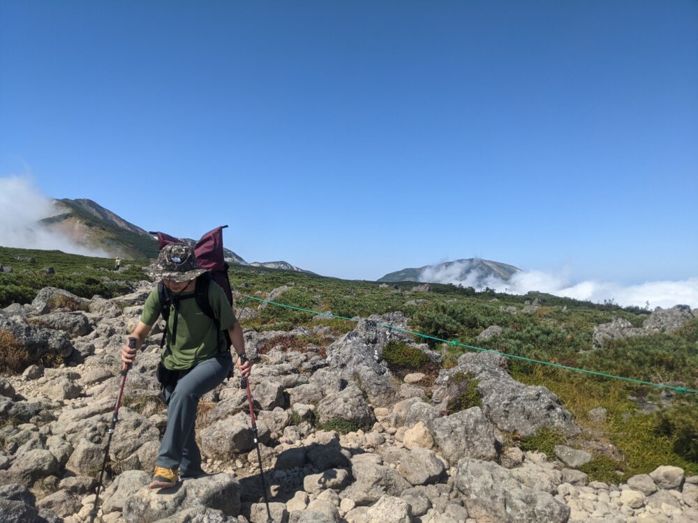
Finally, I took my mother and brother on a mountain climbing trip with me! My mother, who started mountain climbing around the same time as I did, fell in love with it much faster than I did, and this time we decided to go on our long-awaited overnight stay in a tent. Incidentally, this is the second time for me to stay in a tent. The first time I stayed in a tent on Chogatake , it was a very difficult debut in a tent where I learned the harshness of nature…. So…! I went on a filial piety tent-night stay!
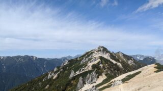
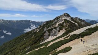
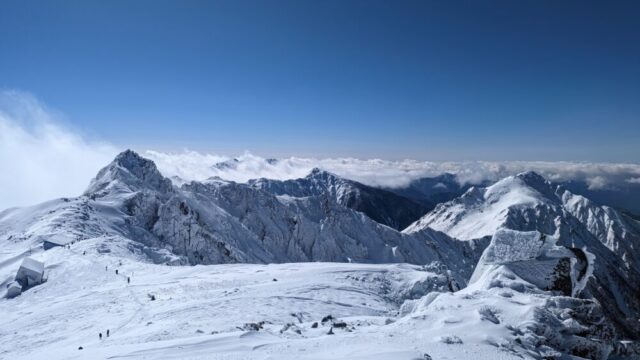
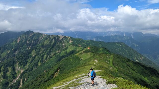
View from the trailhead to the summit
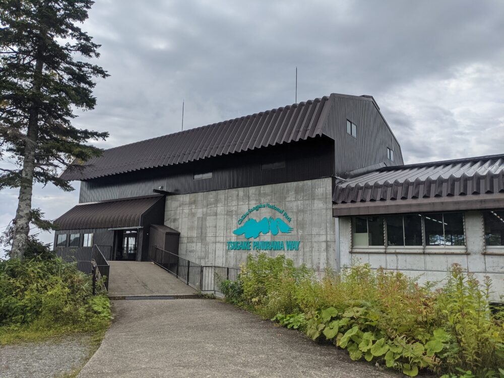
The parking lot was empty even at 8am on a weekday morning, but not so on a holiday…. From there, you can take Tsugaike ropeway to Tsugaike Sanso (mountain lodge). That will be the trailhead.
Tsugaike Ropeway
Round trip: Tsugaike Gondola & Tsugaike Ropeway (without admission fee to Tsugaike Nature Park): Adult fare 3,380yen
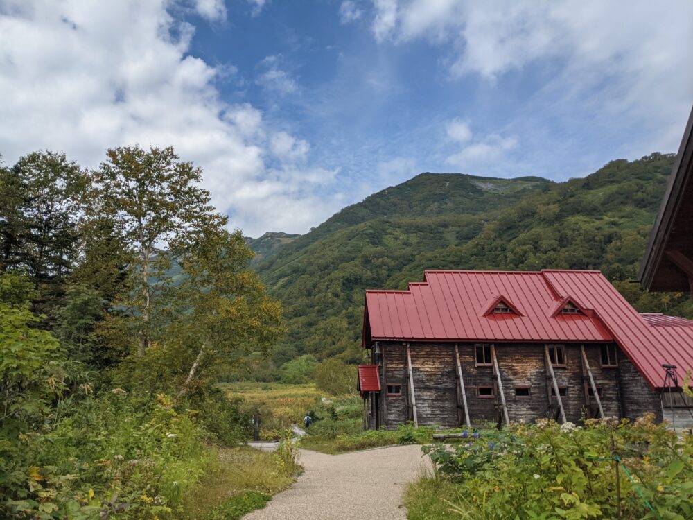
10:00 Tsugaike Nature Park
A 30 minute ride on the Tsugaike ropeway will take you to the Nature Station. Start climbing from here! Tsugaike Nature Park has one of the best wetlands in Japan, where you can see various animals and plants. There are wooden paths spread throughout the park, and it seems that it takes about 5.5km around the park, or about 3.5 to 4 hours to make a round trip! This time, I’m mainly climbing the mountain, so I’ll leave it for another time.
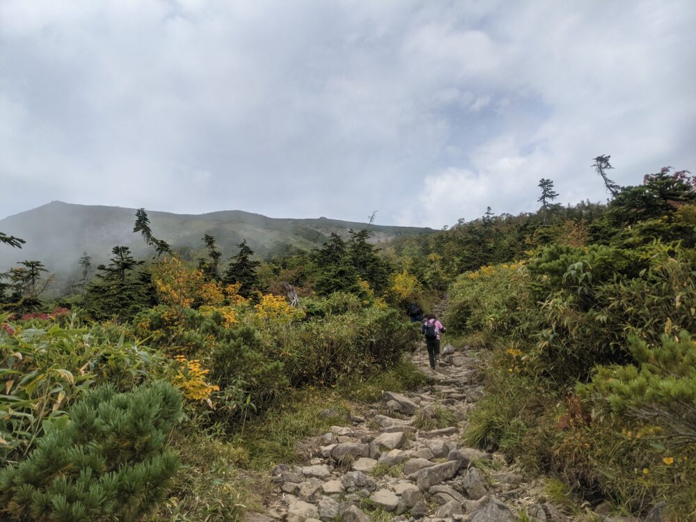
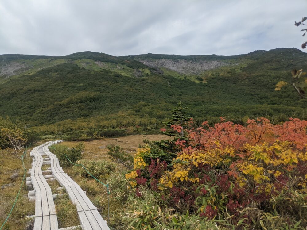
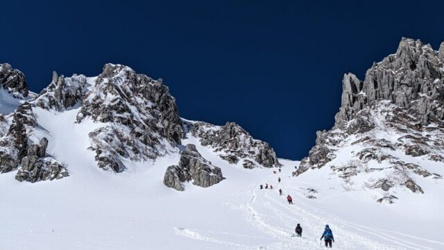
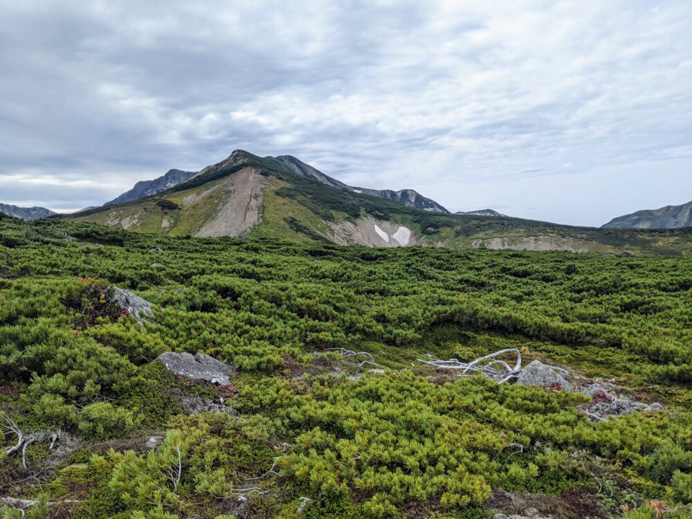
11:15 Tengu field
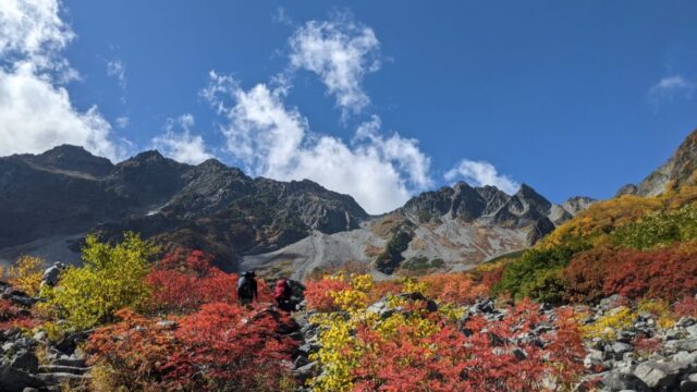
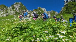
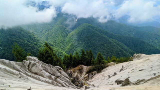
The first part of the climb is not steep, but you may find it a little tough in the forest area. 1 hour later, you will reach the Tengu field, where a wooden path extends through a marshy area. There are many alpine plants around the wooden path.
12:00 p.m. Mt.
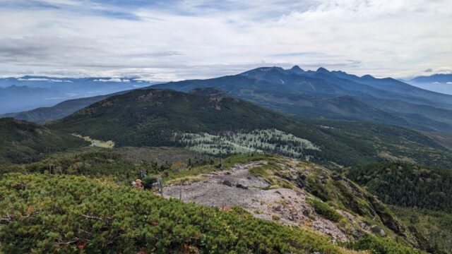
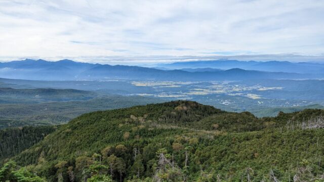
After about two hours of climbing, we reached the summit of 2,469m Mt! The summit of Mt. Hakuba Norikura is flat and covered with Japanese spruce, and there are no clear peaks. If you are aiming for Hakuba Ooike, you will surely pass by it! The view from here was also spectacular, and I loved it!
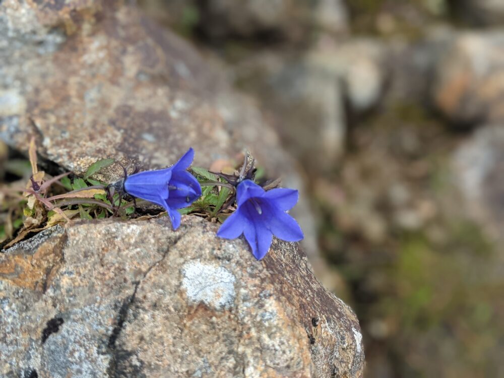
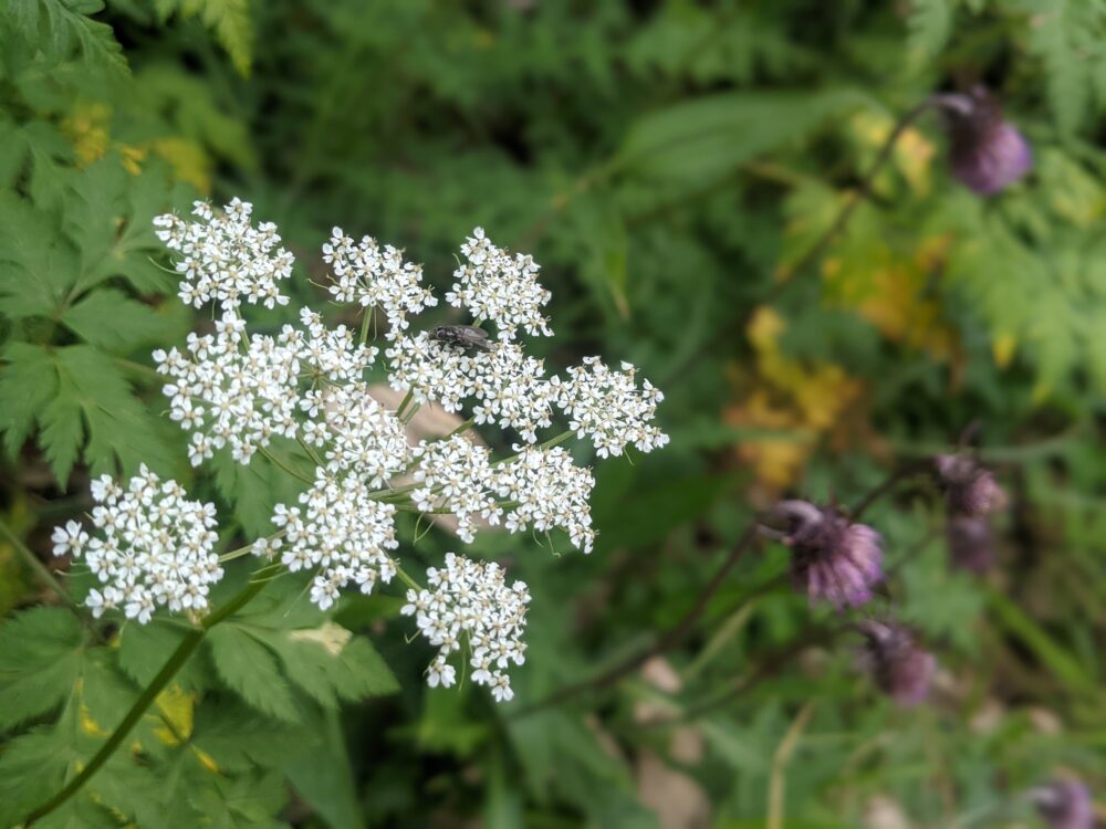
Many alpine plants are in full bloom even at this time of the year, and I can’t help but take pictures of them. I always feel that it would be more enjoyable if I knew the names of the flowers.
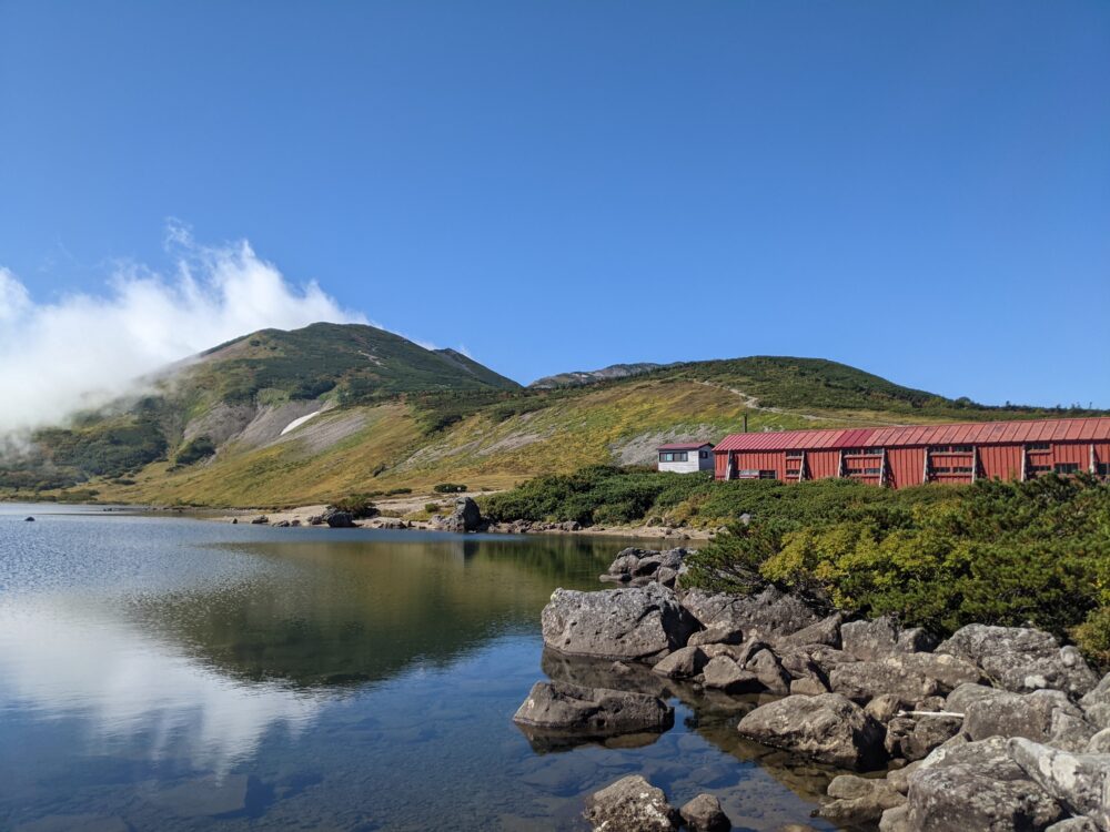
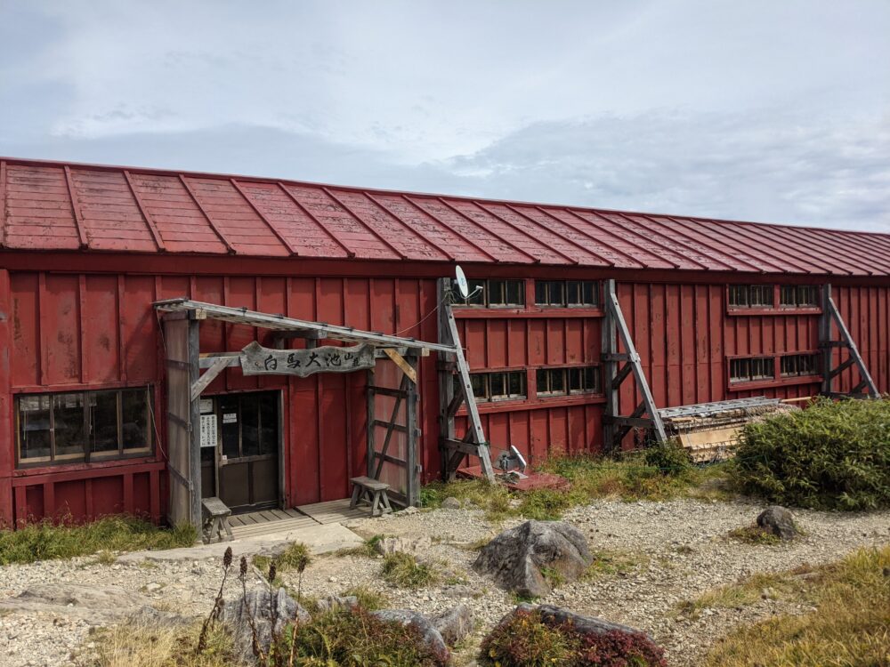
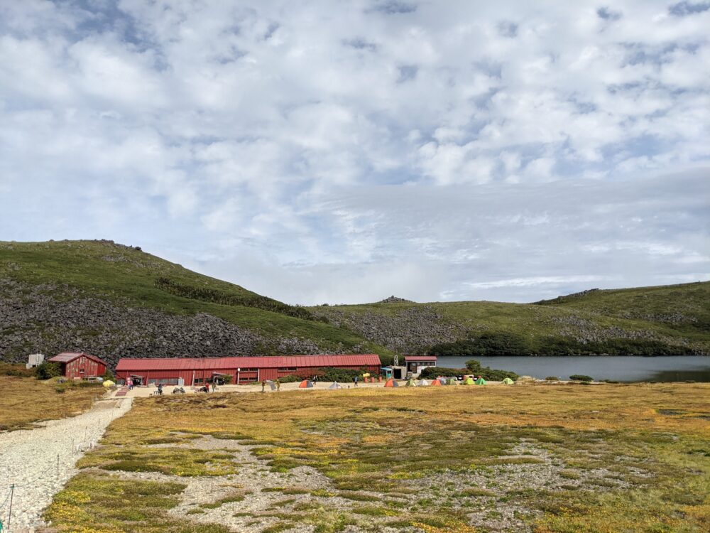
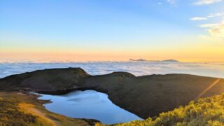
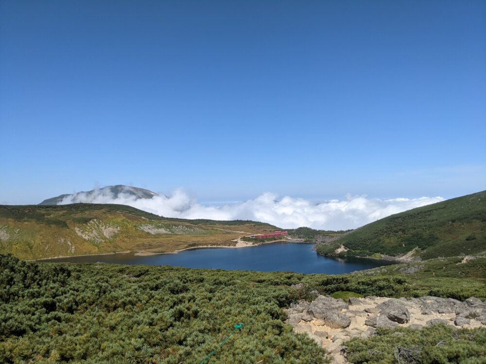
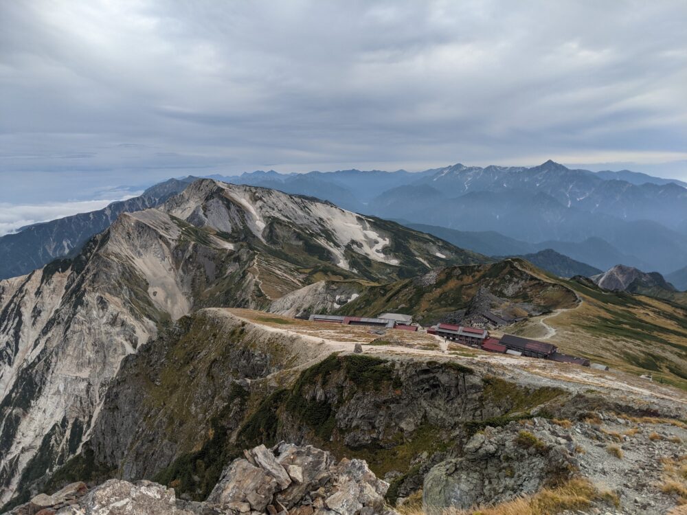
12:40 Hakuba Ooike Villa 2,379m
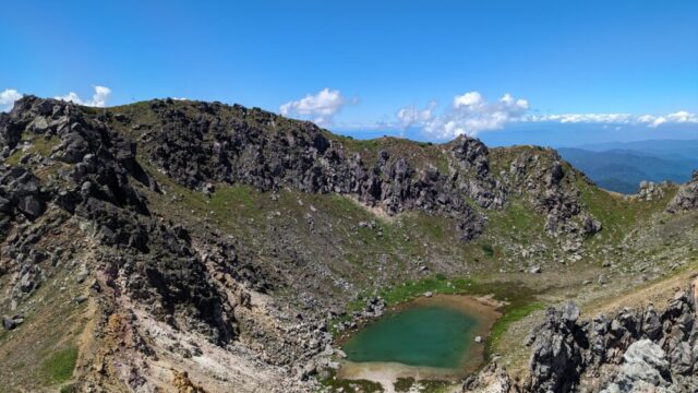
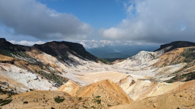
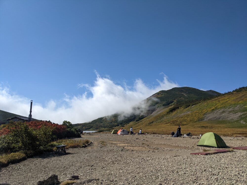
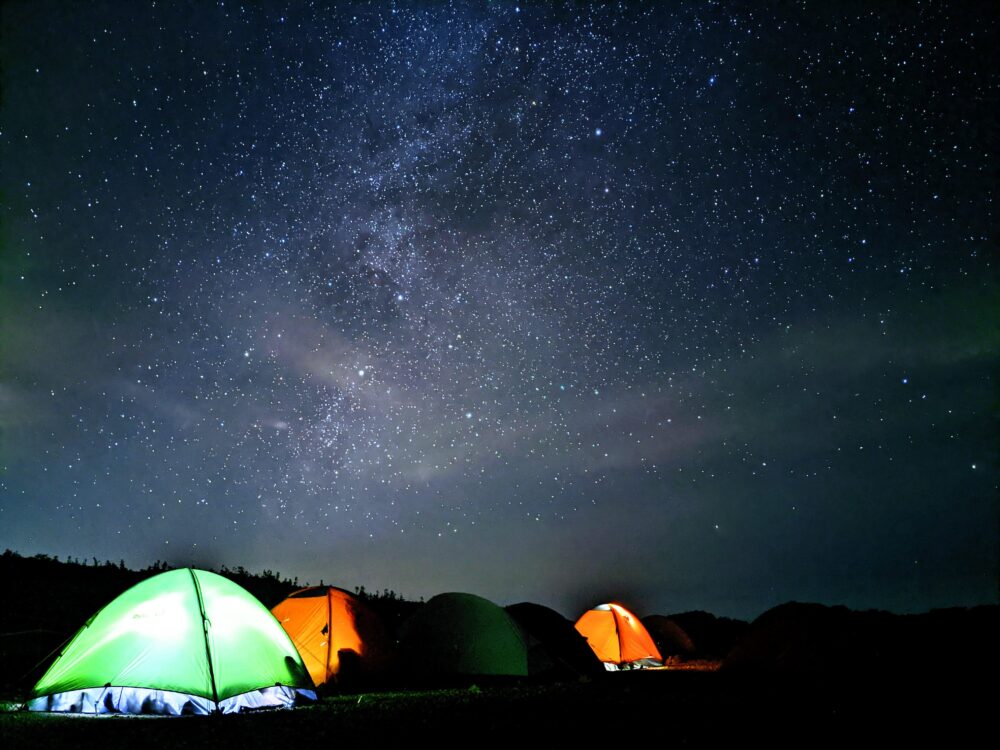
We arrived at Hakuba Ooike in about 2 hours and 40 minutes from the start of our ascent! Hakuba Ooike is the second largest lake (crater lake) in the Northern Alps! The water source is all melted snow that flows into the lake, and it does not seem to be very deep, about 4 meters deep. There were salamanders! (The largest lake in the Northern Alps is Fubuki Great Pond.) The fact that there is such a large lake at 2,379 meters makes us feel the wonder of nature. There is also a mountain lodge and a campsite for tents! Water could be replenished free of charge!
Hakuba Ooike Villa
1,000 yen per tent, camp fee Adult / 1,500 yen Elementary school student and under / 1,500 yen *Reservations by phone only
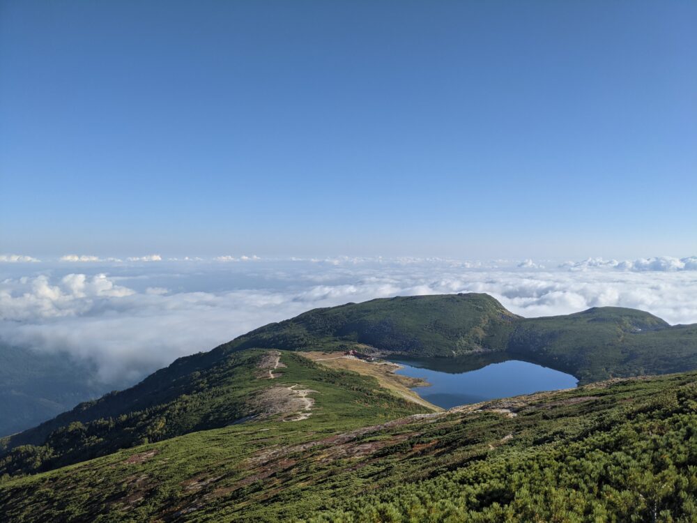
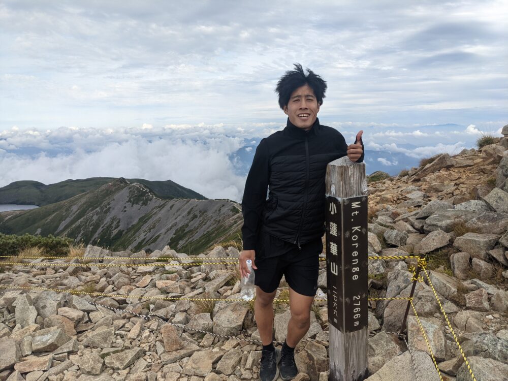
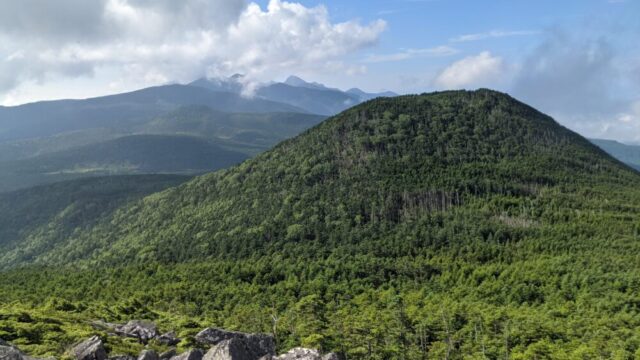
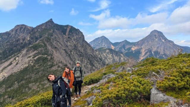
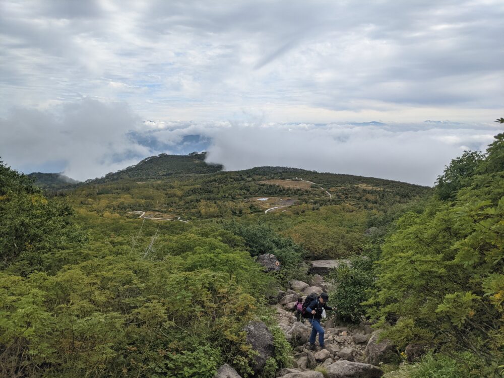
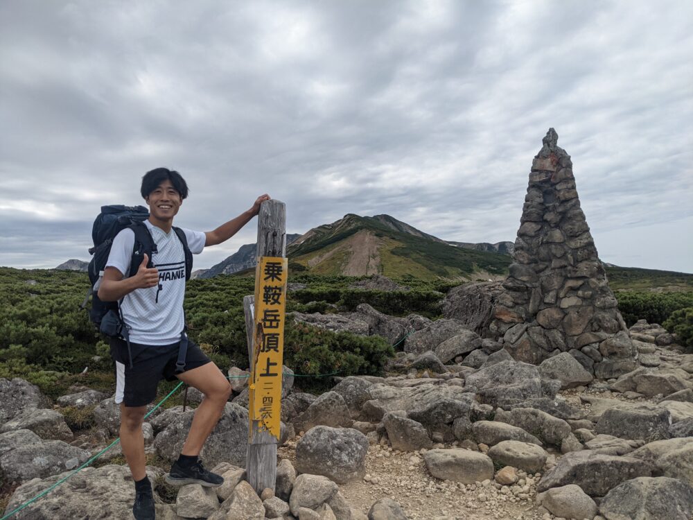
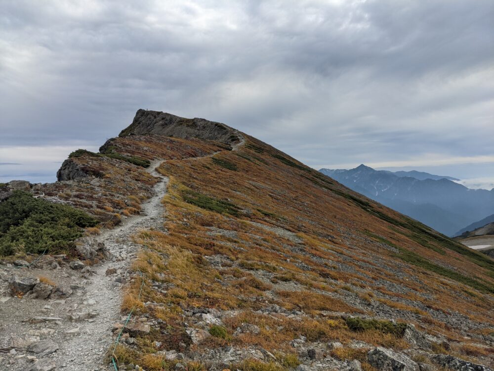
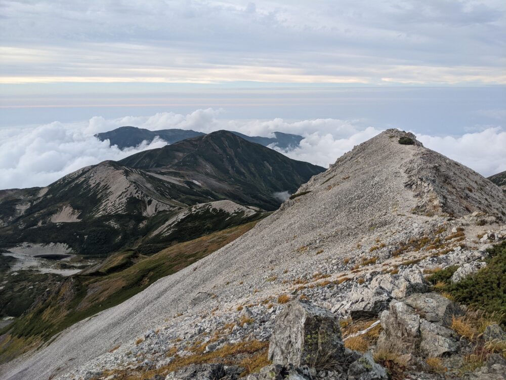
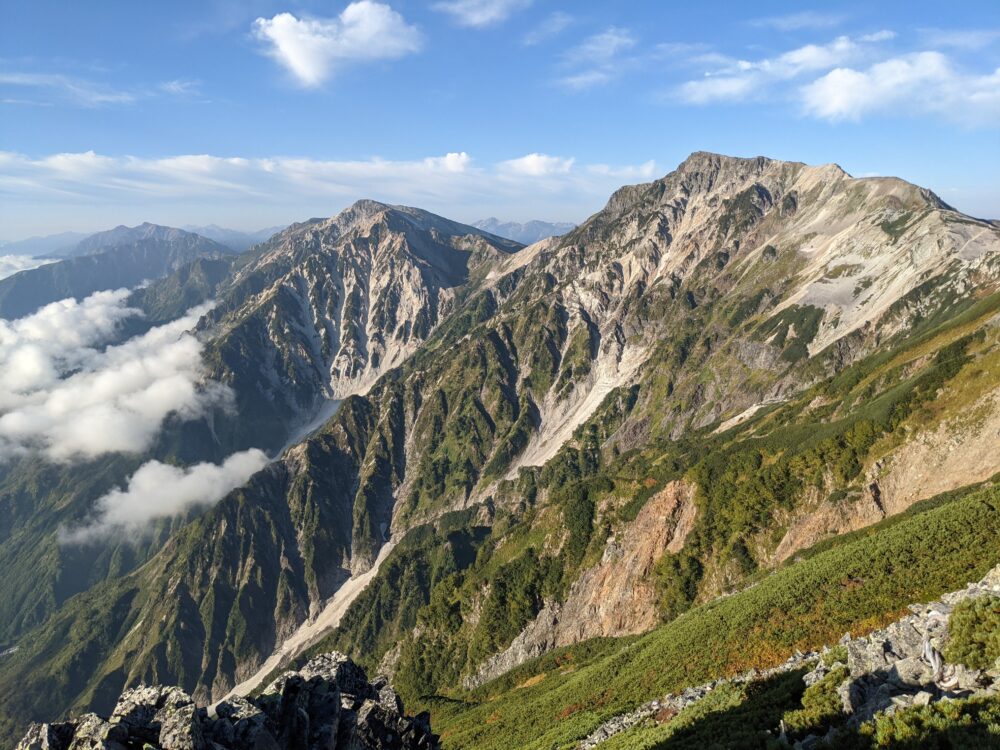
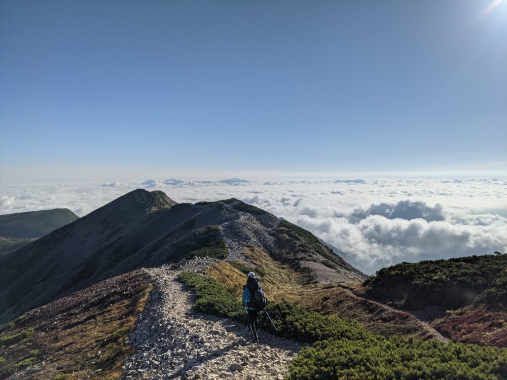
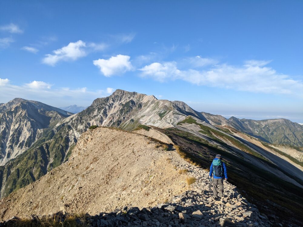
15:00 Ko-rengezan 2,766m
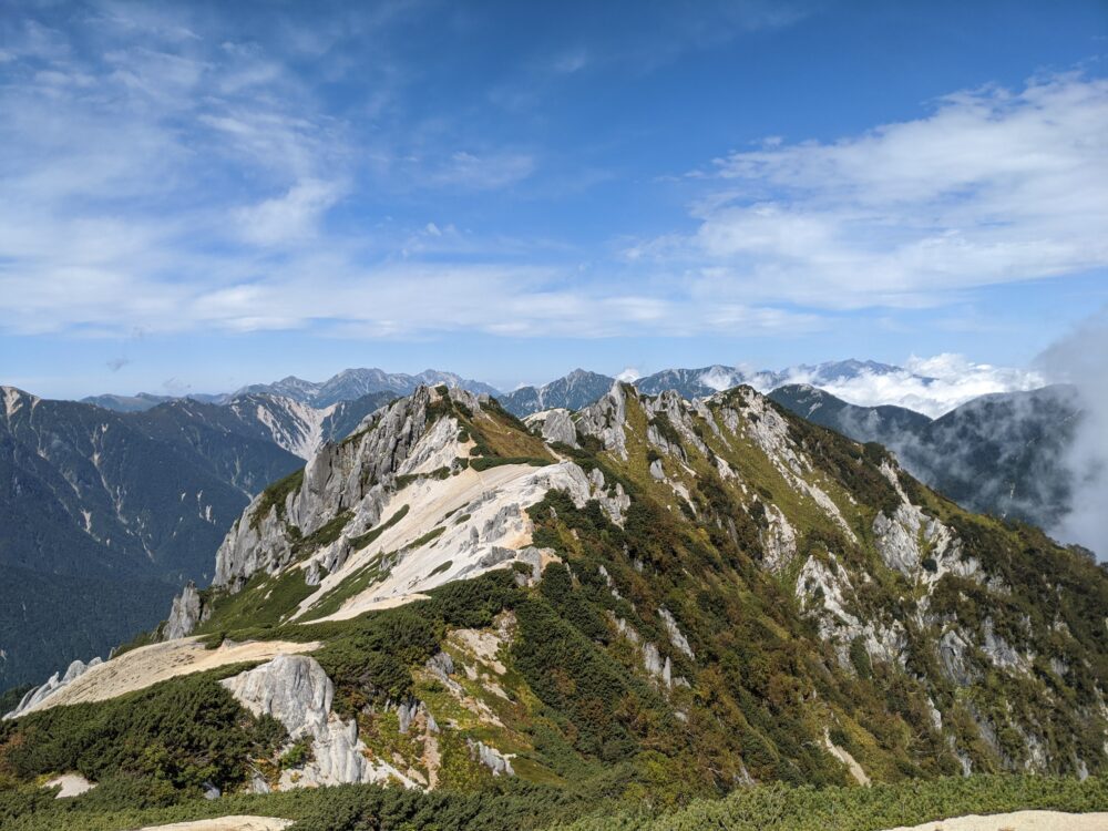
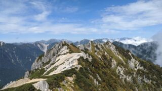
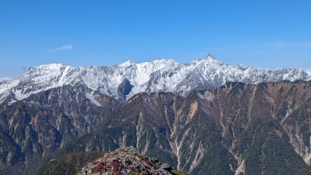
We pitched our tents at the Hakuba Ooike campground, took a rest, dropped off our luggage, and off we went! It took us about 1 hour and 10 minutes from Hakuba Ooike to reach the summit of Mt! If you look behind you on the way up, you can see Hakuba Ooike Pond from above! If you look further to the left, you will have a spectacular view of the Hakuba mountain range (Yarigatake, Shakushidake, and Hakuba-dake)! It is the best!
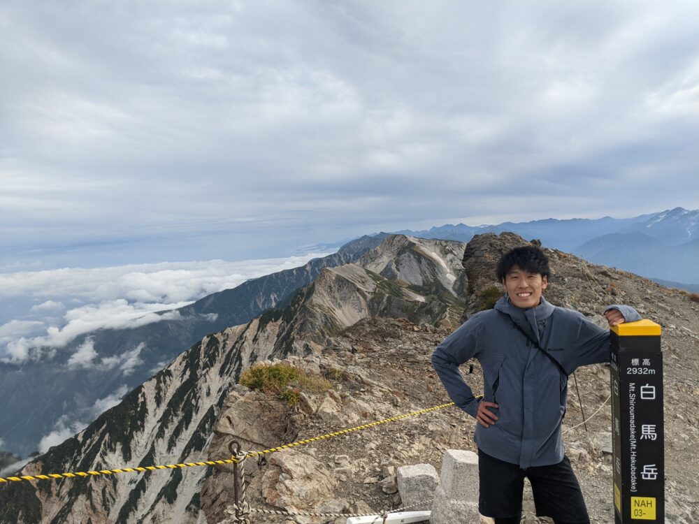
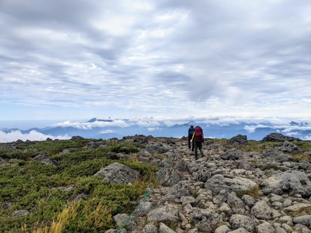
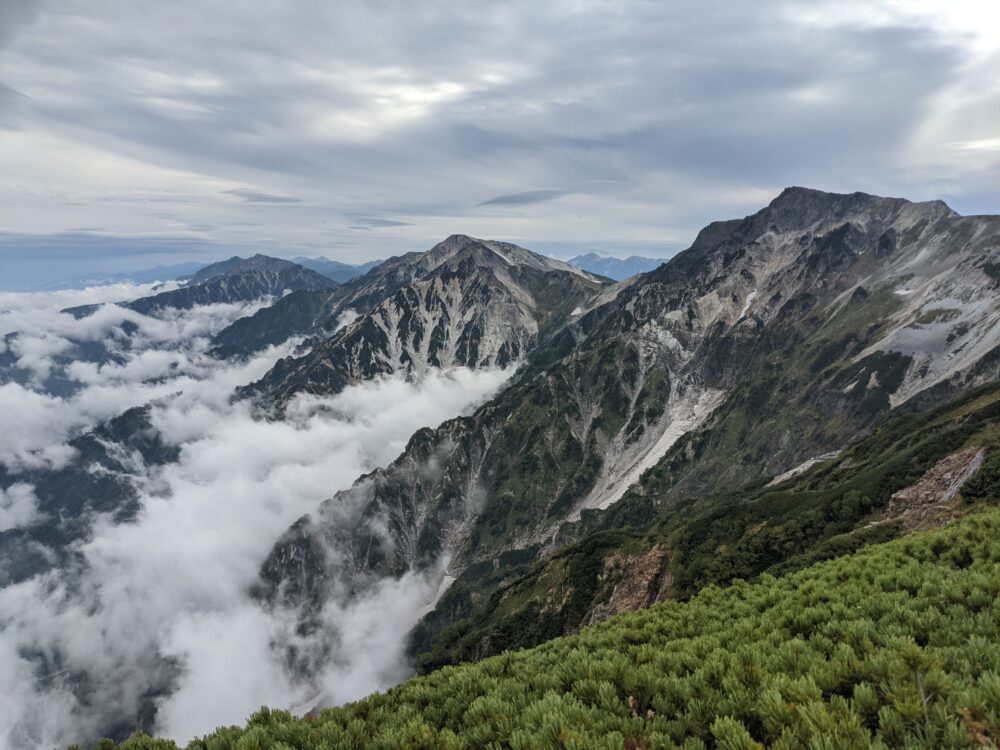
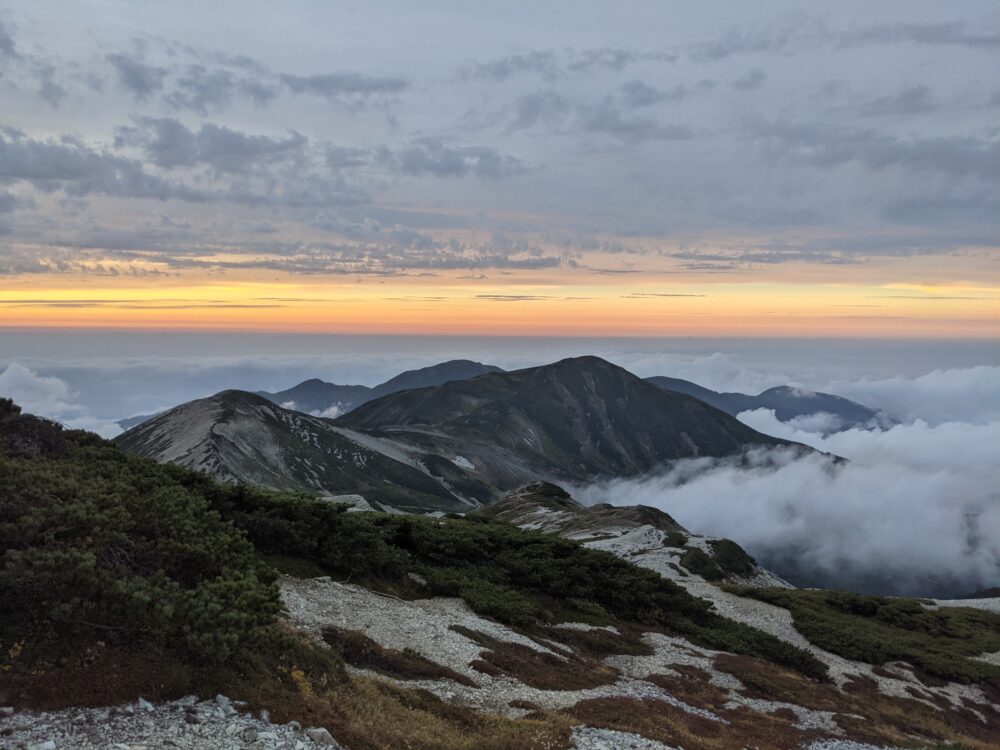
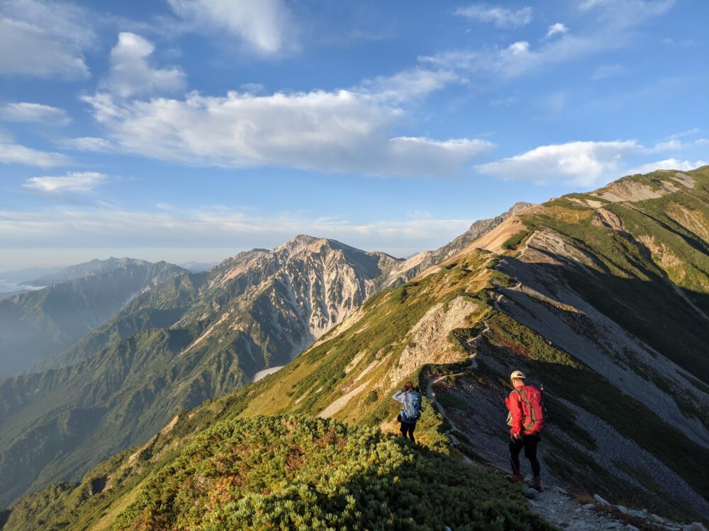
16:00 Mt. Hakuba 2,932m
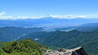
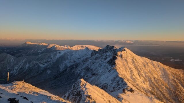
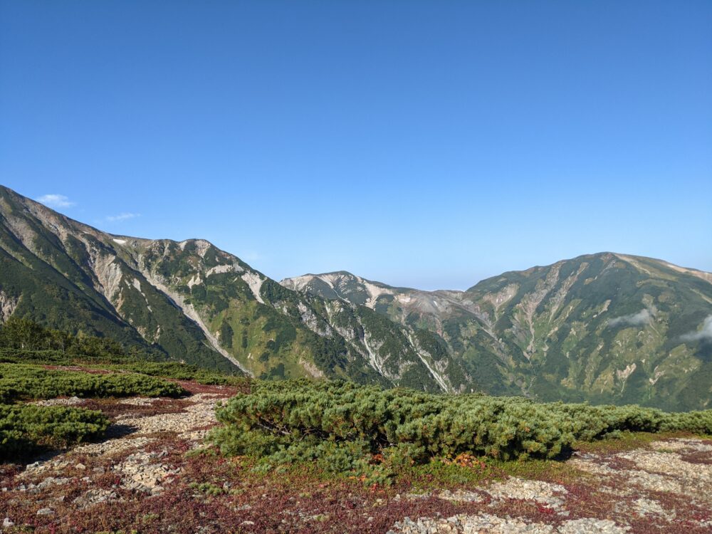
In about 2 hours and 10 minutes after leaving Hakuba Oike, we summited Mount Hakuba, one of the Hakuba mountain range! My brother retired at Mt. (My mother was already down at Hakuba Ooike.) There were no steep paths up there, and I was able to leave my luggage behind and climb without any difficulty! It was a great view! From the summit of Mt. Hakuba, “mountain lovers will love the view of the Southern Alps, Kurobegorodake, Tsurugidake, Dainichidake, and other famous mountains in Japan!
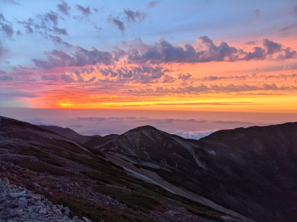
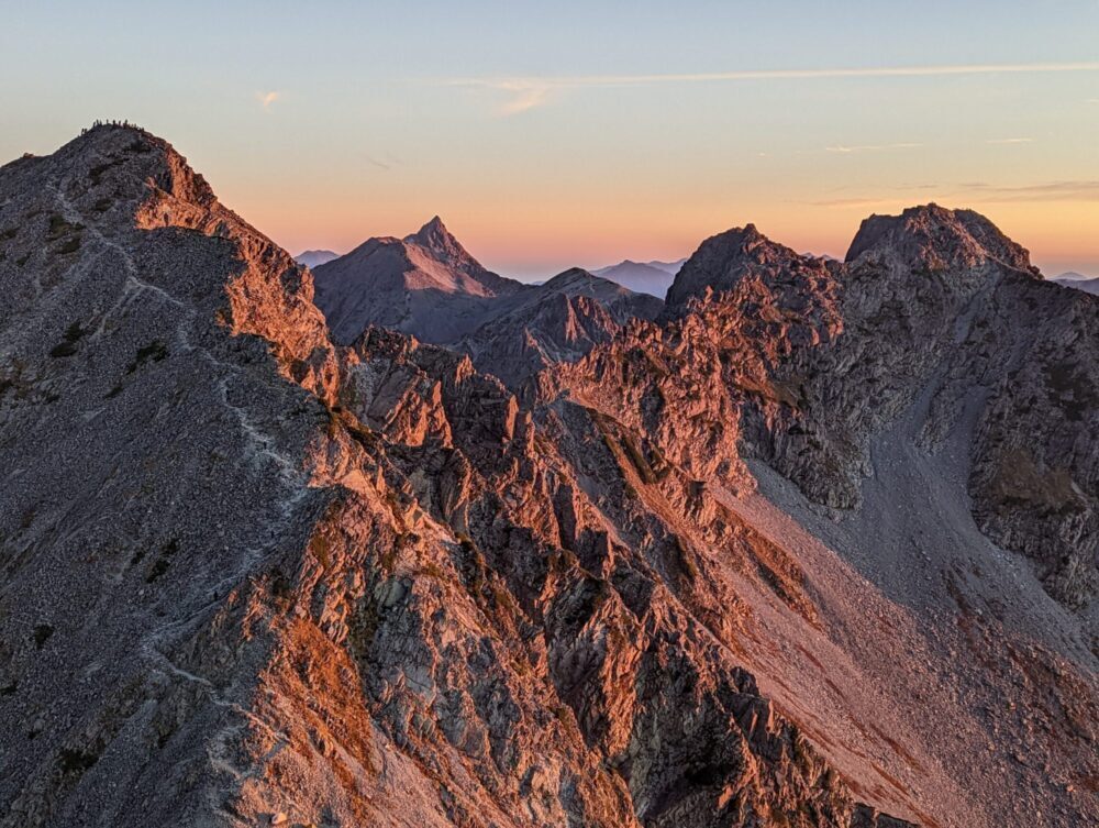
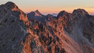
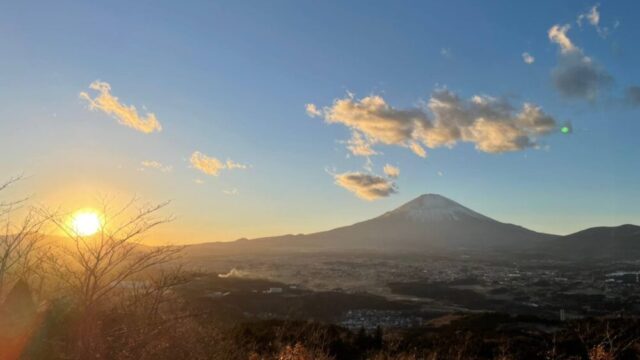
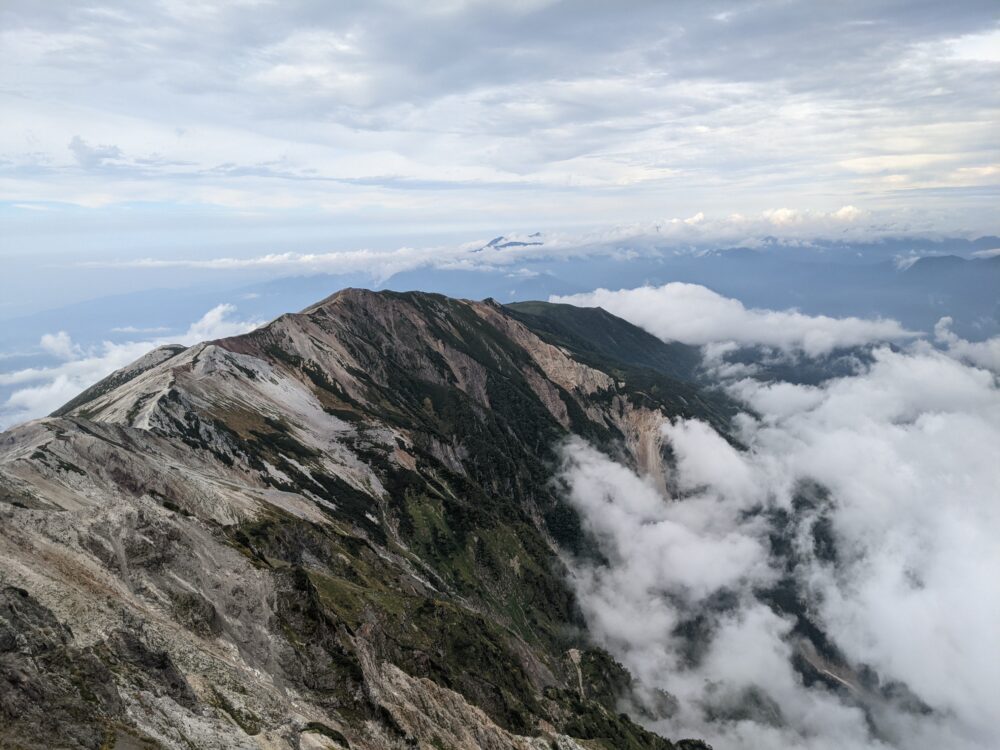
18:00 Sunset
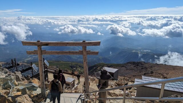
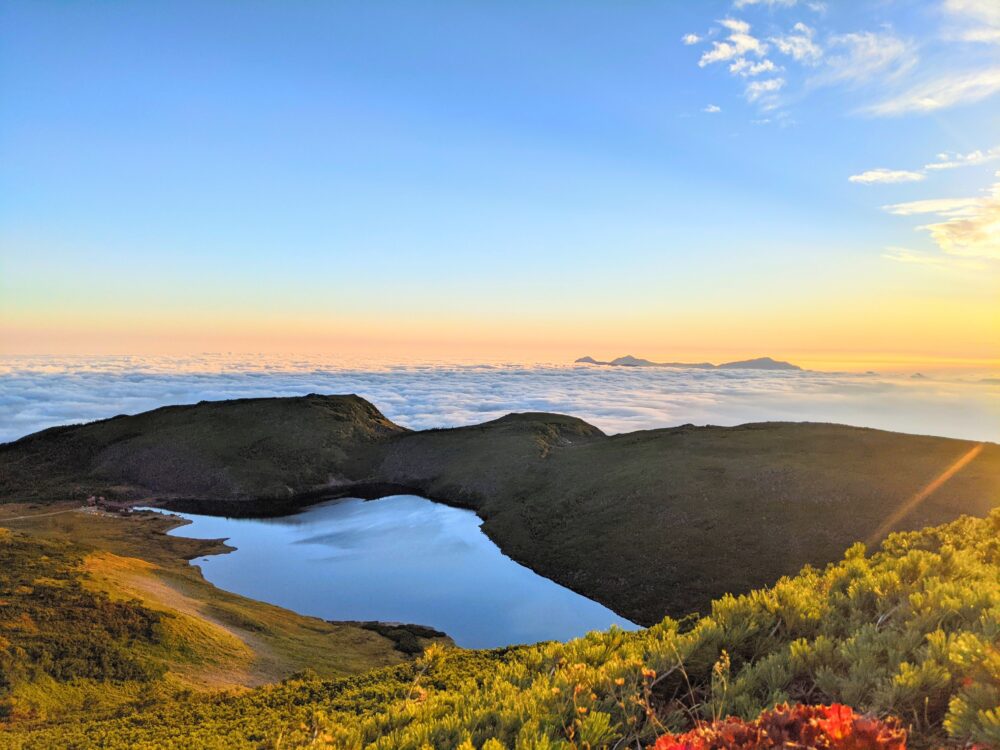
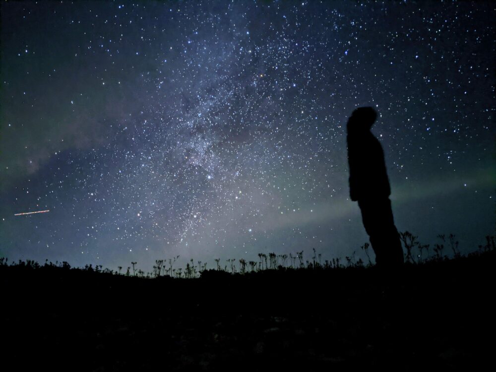
The view was so spectacular that there are no words to describe it. The sea of clouds, sky, and mountains at sunset. It was my favorite view this time.
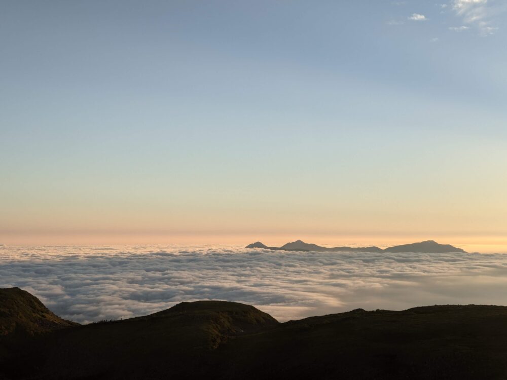

5:50 Sunrise
The sea of clouds and its mountains lit up by the sun’s rays were truly spectacular! It was the best sea of clouds I have ever seen! Please watch the video! You will definitely want to go back!(YouTubeへ)
I think even beginners can do it!
Please give it a try!
Northern Alps Recommended Mountains
There are many other mountains in the Northern Alps that we recommend, so please check them out here!
Mountaineering Preparation and Equipment
Before you begin climbing a mountain, it is important to select and prepare the proper equipment. Here is a checklist of essential items and how to choose climbing equipment such as climbing shoes and backpacks. We will also inform you about important but often forgotten items.
⛰ Clothing ⛰
Shoes
Climbing shoes
Climbing shoes with good foot support and non-slip soles are required. Proper size and fit are important for a comfortable climbing experience.

Climbing clothes
T-shirt, shorts (or long tights if you don't want to get hit by grass), outdoor jacket, heavy socks
Hat, spare T-shirt *Adjust according to the season.

Mountaineering backpack:.
You will need a backpack large enough to hold the necessary equipment, food and drink, and warm clothing. Be sure to pay attention to the comfort and adjustability of the backpack.

Protective equipment
Head and limb protection such as helmets, gloves, and sunglasses are important to ensure your safety while climbing.

Warm clothing
In mountainous areas, temperatures can change rapidly, so it is important to have warm clothing. A fleece, down jacket, windproof and waterproof shell jacket, etc. are necessary.

Trekking poles
Trekking poles are useful to support balance on slopes and unstable terrain.

Mountaineering map application "YAMAP
Download a map of the mountain you will be climbing with the mountaineering map application "YAMAP" in advance. You can check your location with GPS even when you are offline.

⛰ Recommended items⛰.
First aid kit
Headlamp
Drink (This is important! You will need a liter! You need at least 1 liter.
Food - Onigiri rice balls and waders to eat on the way
Snacks
Money (It's better to have cash since it's not electronic!)
Insect repellent (you don't have to bring any)
Towel
Sunscreen
Tissues, wet wipes
Charger
Folding umbrella or umbrella